
GeoNet NZ Volcano
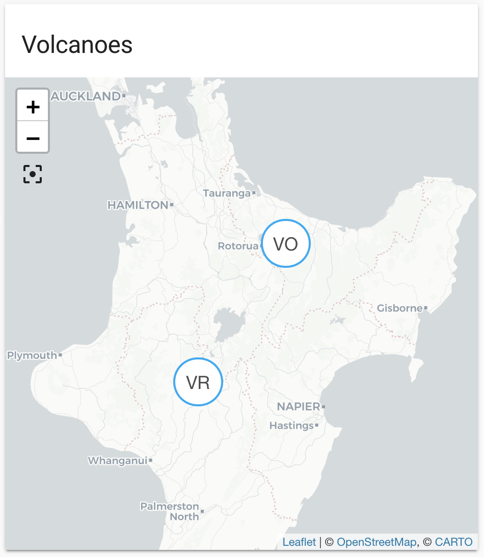
The GeoNet NZ Volcano integration lets you use a GeoJSON feed provided by New Zealand's GeoNet with information about volcanoes in the New Zealand region. It shows information of those volcanoes filtered by distance to Home Assistant's location.
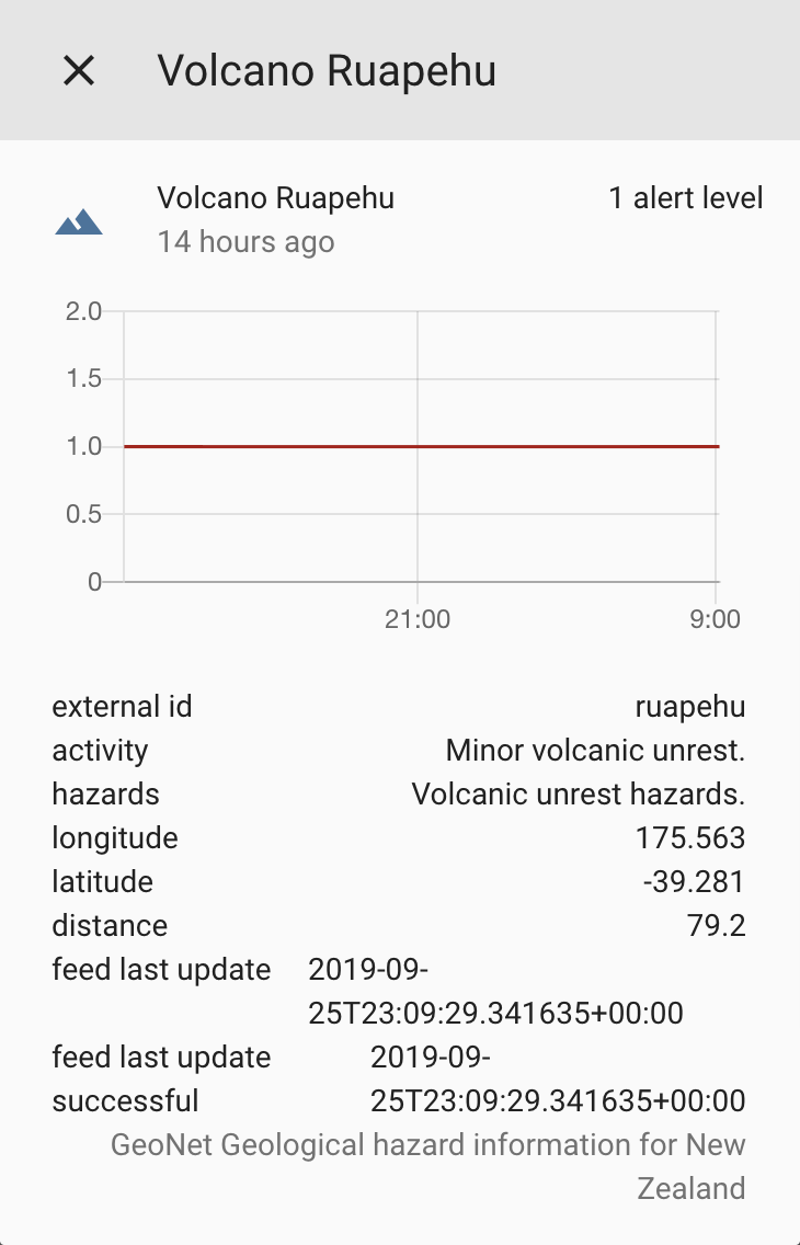
Entities are generated and updated automatically with each update from the feed. Each entity defines the volcanic alert level as its state. Latitude and longitude of the volcano are included as attributes to show on the default map automatically.
The data is updated every 5 minutes.
The material used by this integration is provided under the Creative Commons Attribution 3.0 New Zealand (CC BY 3.0 NZ) license. It has only been modified for the purpose of presenting the material in Home Assistant. Please refer to the creator's disclaimer notice and data policy for more information.
We acknowledge the New Zealand GeoNet project and its sponsors EQC, GNS Science and LINZ, for providing data/images used in this integration.
::: :::note 配置 此集成可通过 UI 配置。前往 设置 > 设备与服务 添加。
State attributes
The following state attributes are available for each entity in addition to the standard ones: